In summer 2023, my team at N.A.S.A. DEVELOP partnered with Little Manila Rising to assess air quality in the San Joaquin Valley - making the invisible, visible
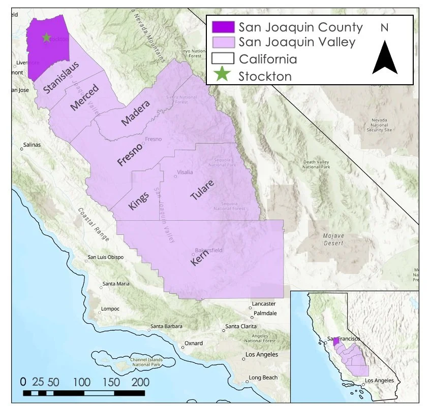
The San Joaquin Valley sits within California’s Central Valley - an area responsible for producing roughly 25% of America’s produce.
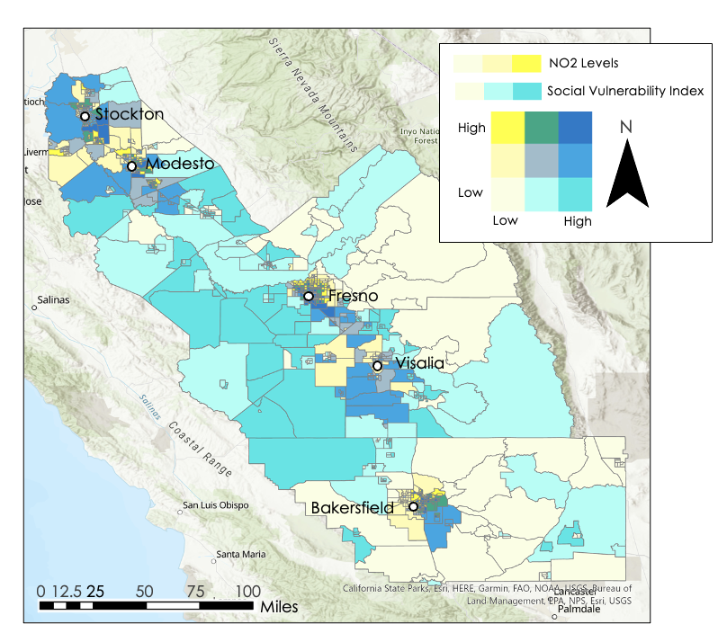
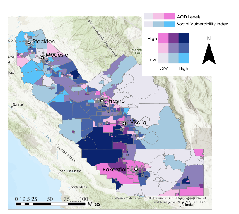
We examined Nitrogen Dioxide (NO2) and Aerosol Optical Depth (AOD), using Sentinel 5-P TROPOMI and Aqua / Terra MAIAC respectively.
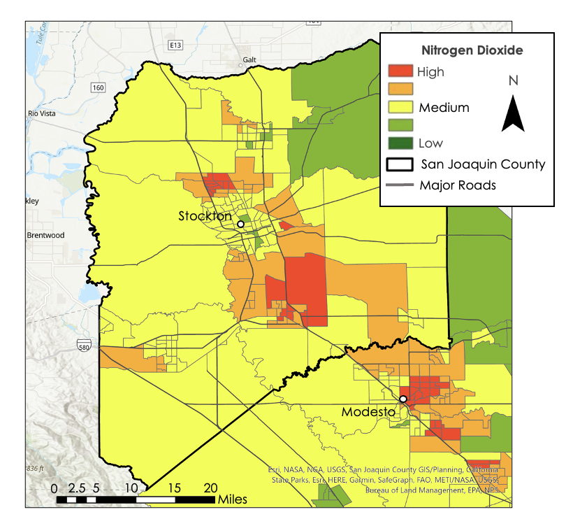
In 2022, NO2 levels were highest around urban areas and transportation corridors.
NO2 is a precursor to ground-level ozone, an aerosol linked to respiratory illness.
AOD levels were highest in agriculturally designated census tracts.
This is likely due to crop burning, and the natural wildfires in the region.
Examining social vulnerability, in conjunction with air quality, helped us identify which populations (by census tract) in San Joaquin Valley were most at risk.
Over a longer time period, NO2 and AOD had consistent peaks each year in San Joaquin Valley. 2020 and 2021 saw particularly high levels of AOD - likely due to extreme wildfires in the region.
Maps of San Joaquin County, where Little Manila Rising is located, were also created - to aid in their outreach and environmental justice campaigns.
We examined the same metrics outlined in the maps above, but isolated to San Joaquin County.
If you wish to learn more about my team’s analysis, follow these links!