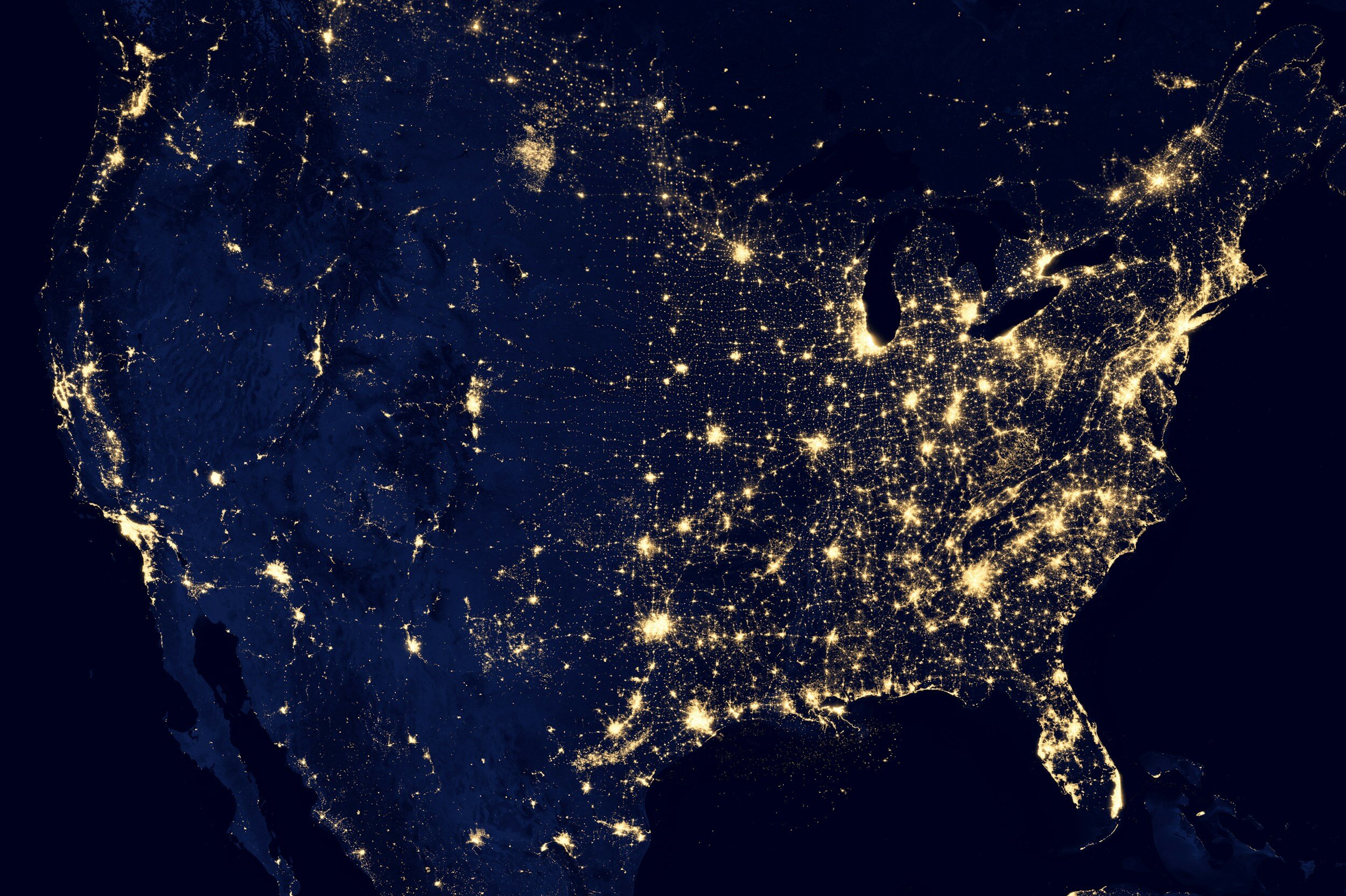
Other Independant Visualizations
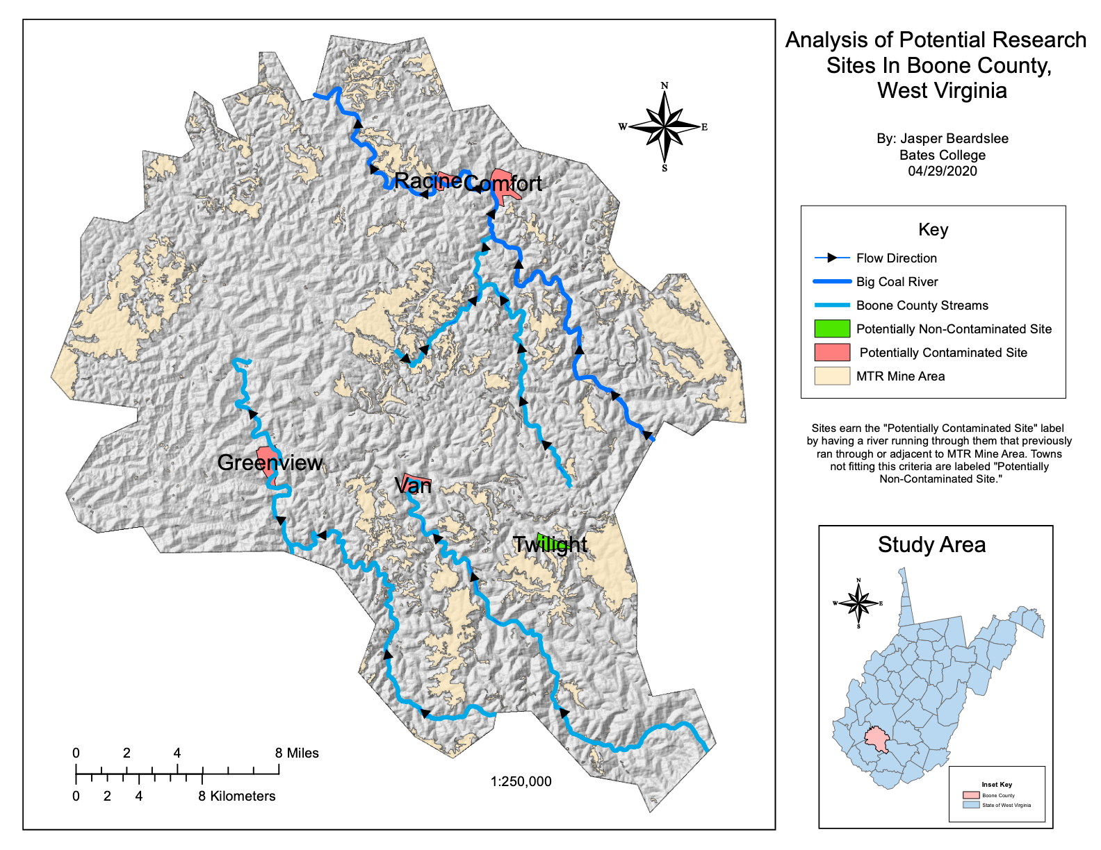
Identifying Potentially Contaminated Groundwater in Boone County, West Virgina.
This map aimed to help future researchers select water sampling sites in Boone County, West Virginia.
Mountaintop Removal Mining (MTR) processes release harmful heavy metals into local air and water. Streams running through these areas easily become contaminated.
These infected streams then feed into local drinking water infrastructure, exposing residents. By examining the proximity of water sources that run adjacent to MTR sites, we can identify towns that may see a higher burden of chemicals and heavy metals in their drinking water.
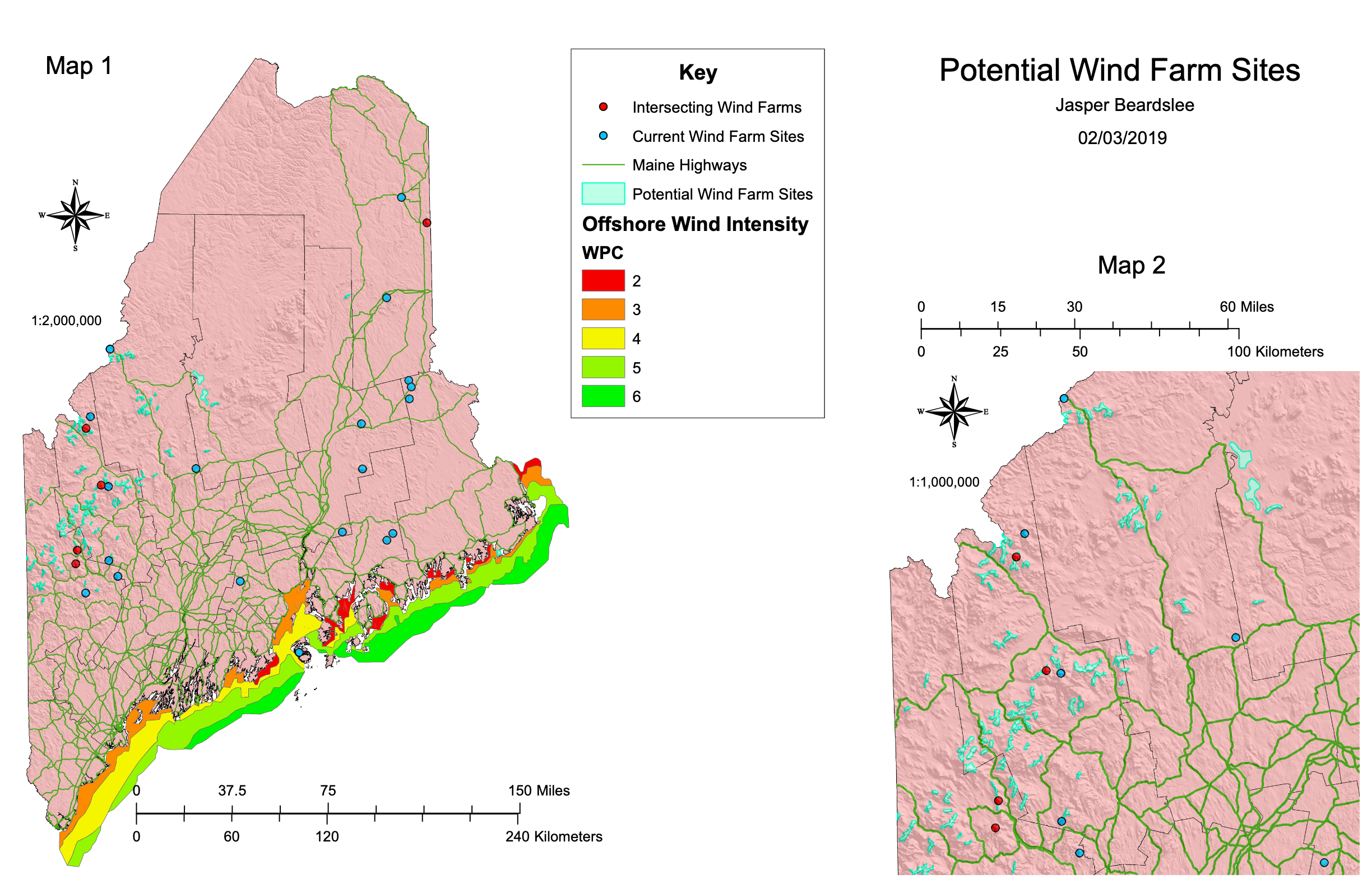
Analyzing the Potential For Wind Farm SItes in Maine.
This map was designed to show potential future wind farm locations (marked as blue dots).
To earn this label, the wind farm site must be easily accessible from an existing highway, within an area already delineated by the state as usable for renewable energy (the teal area), and not already be in use (some of the prime locations already have wind farms on them, marked as red dots).
The project manager was particularly interested in North Western Maine, so an inset was included. Alongside this, I modeled offshore wind intensity for potential offshore wind farm use.
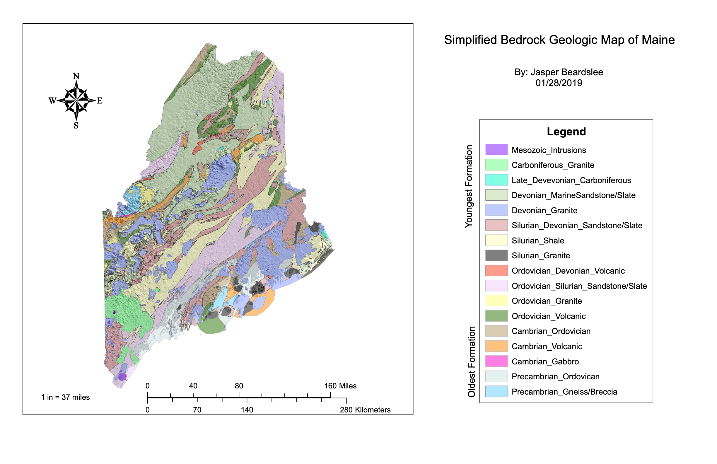
Bedrock Geology in Maine
This simple map shows different bedrock type delineations throughout the state of Maine! This was one of the first maps I ever created, and it taught me so much.
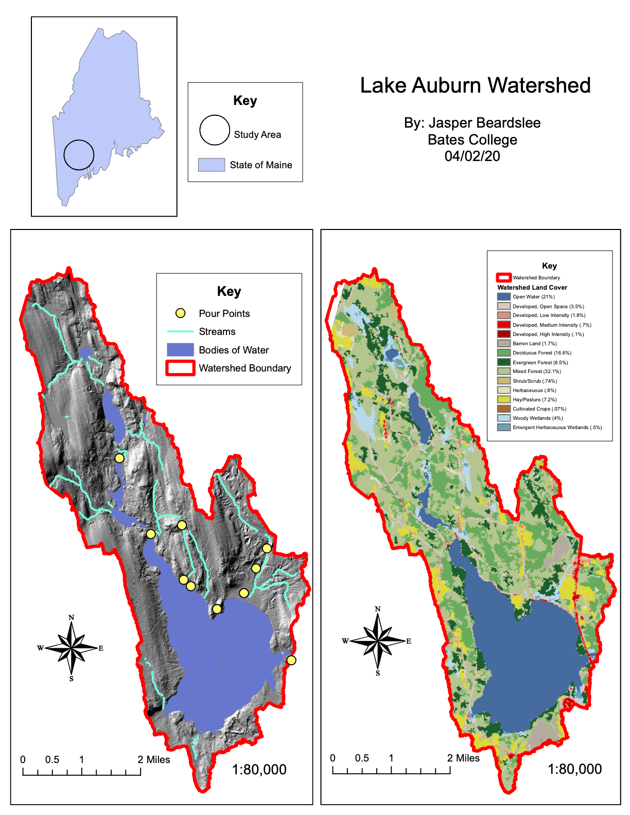
Modeling the Lake Auburn Watershed in Lewiston-Auburn, Maine.
This map was designed to show the major pour points for the Lake Auburn watershed in Lewiston-Auburn, Maine.
Alongside watershed data, a land use map was created so that we might better understand the land classification surrounding the identified pour points.